Academic Project
Work: Research, data collection, GIS analysis
Location: New York
Date: 2019
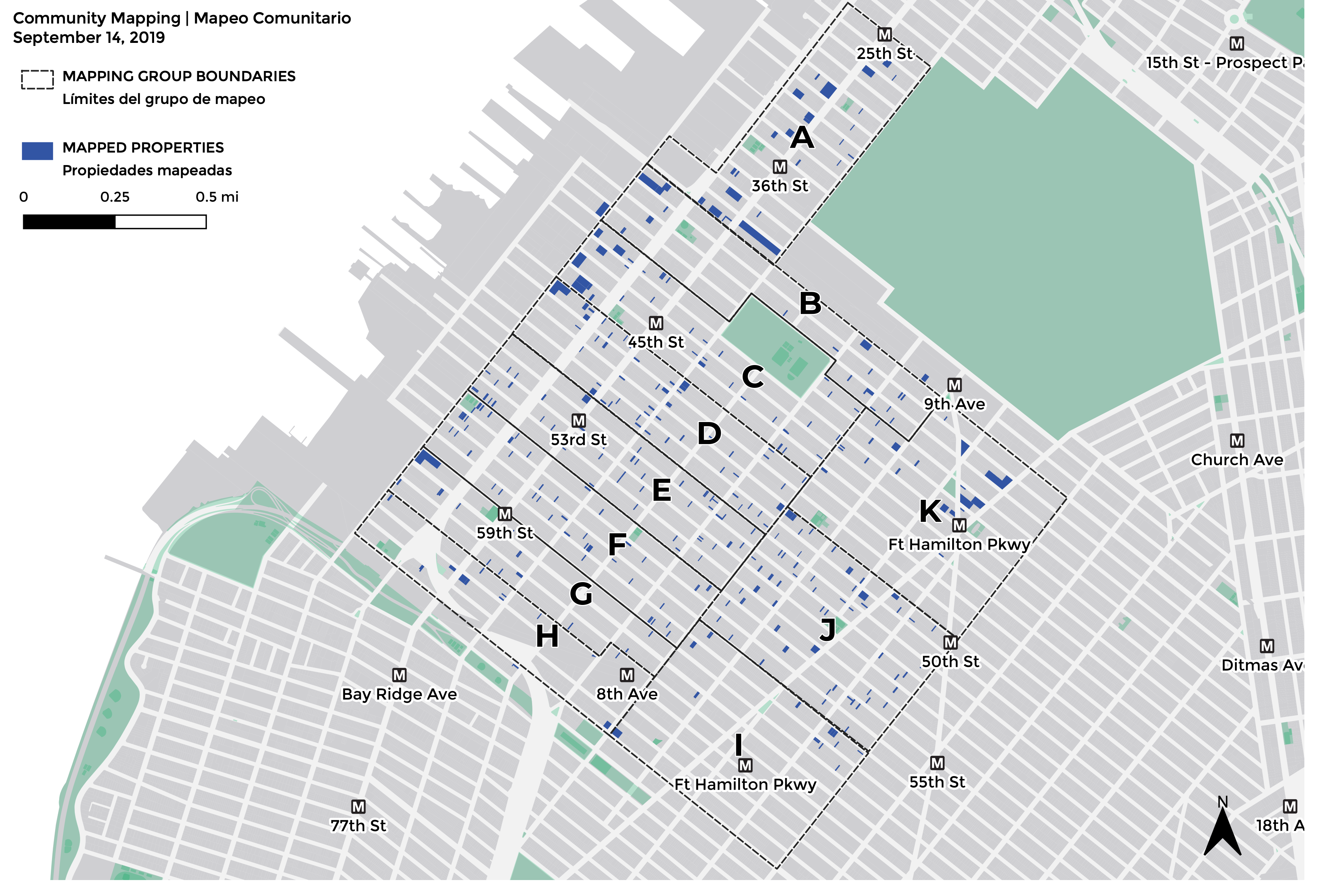
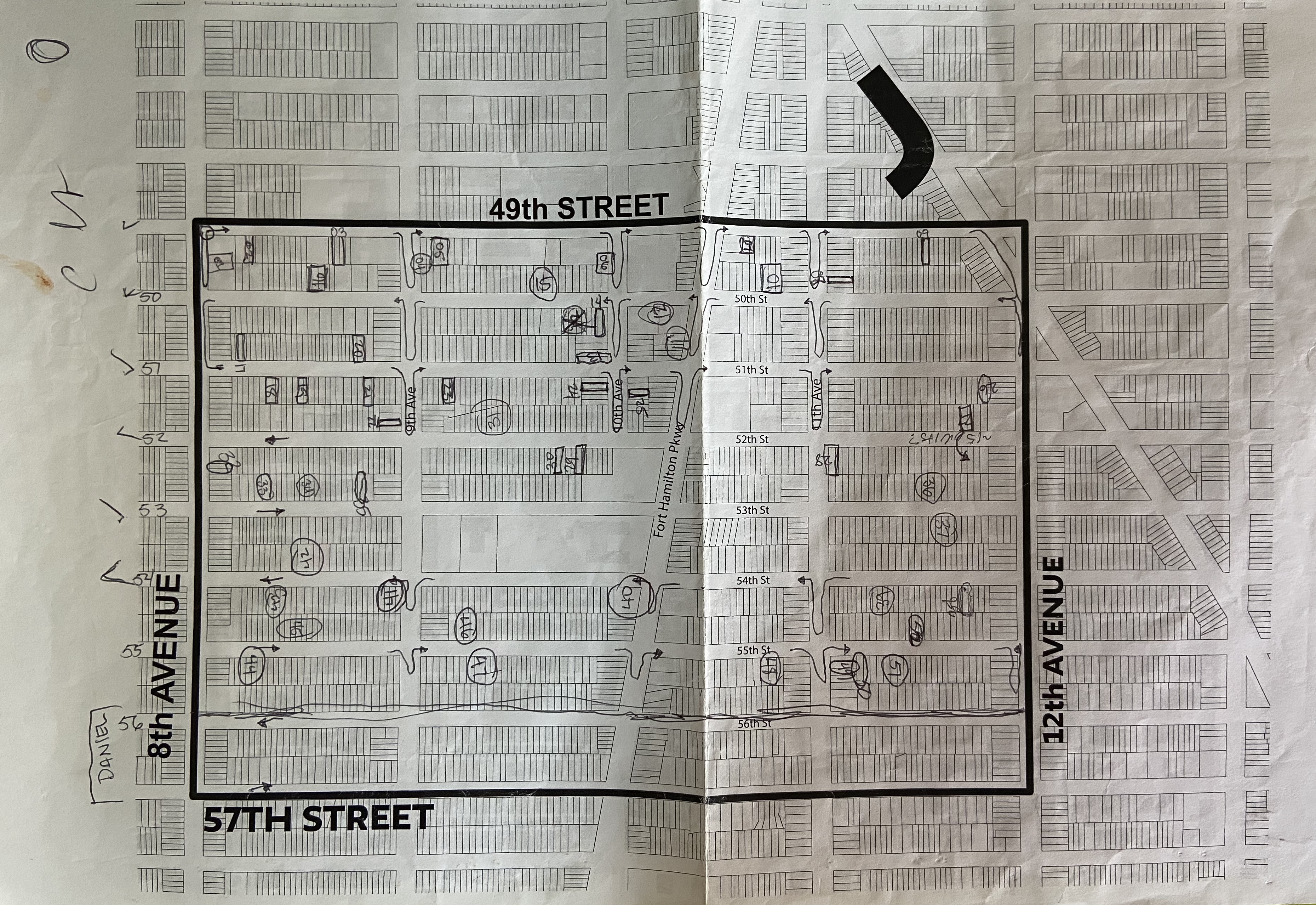
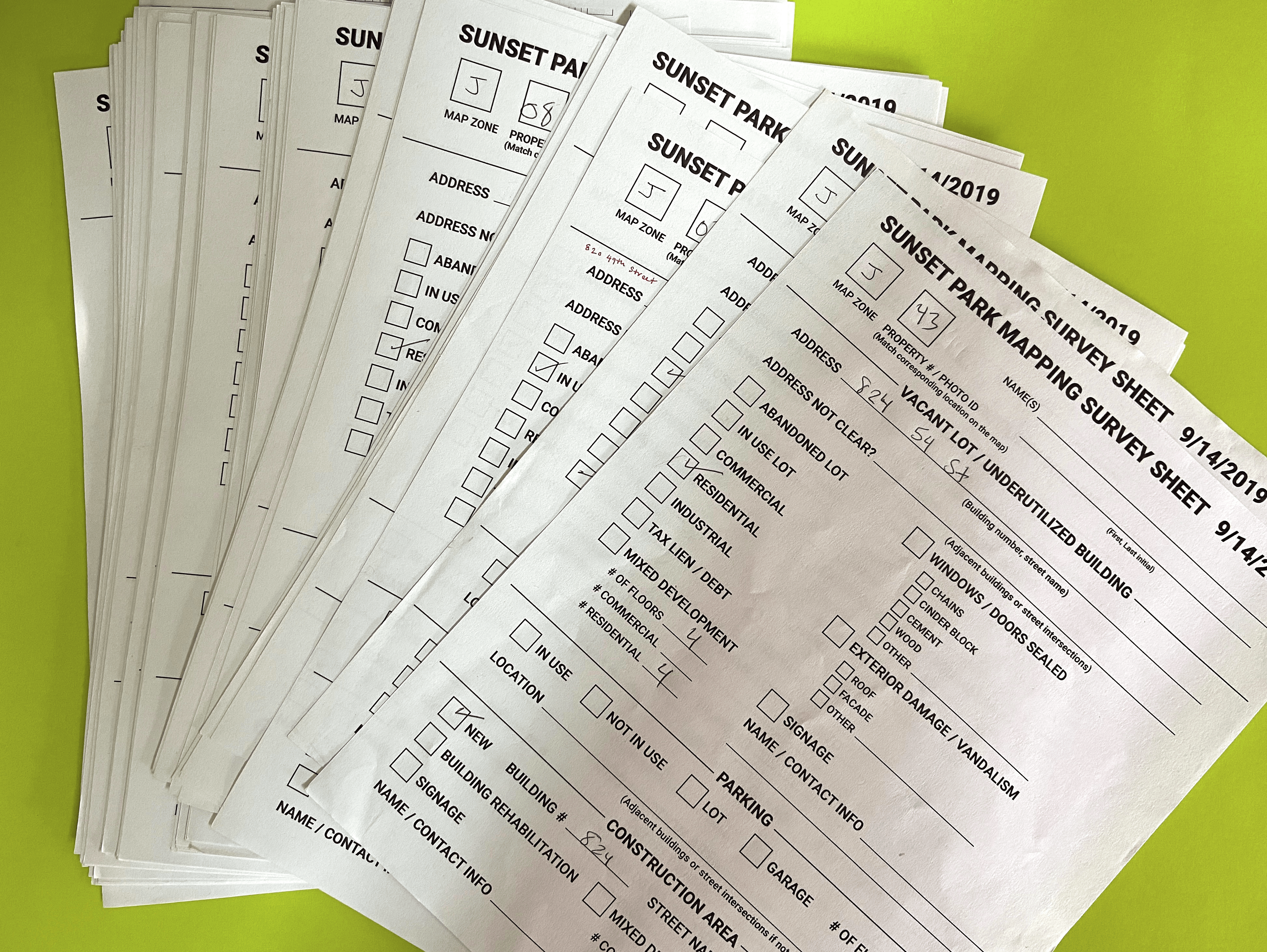
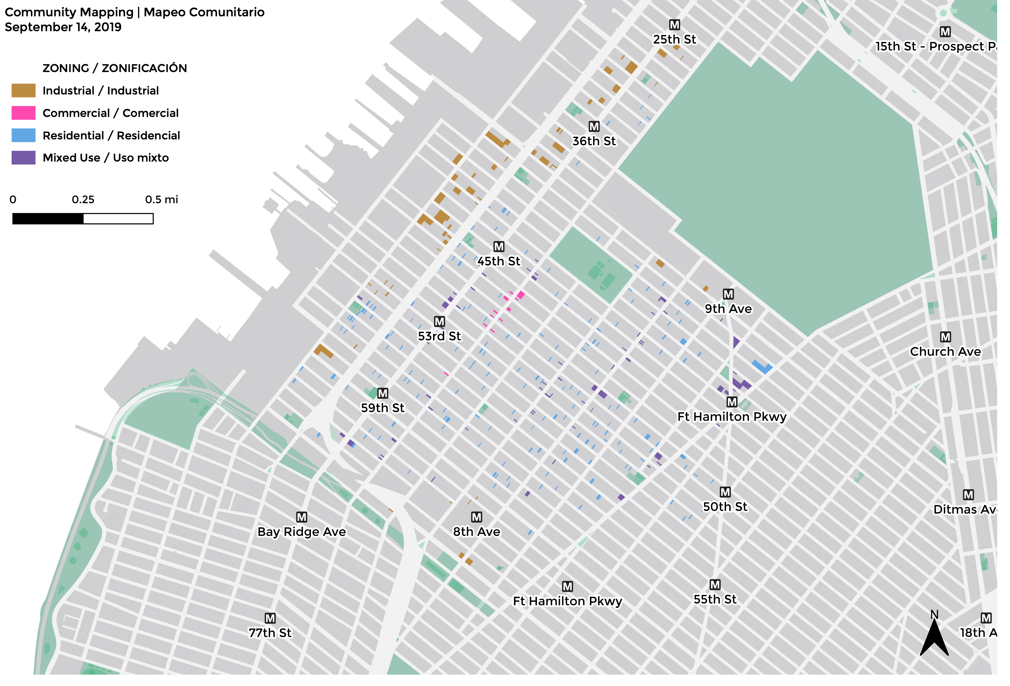
I was responsible for taking the results of our studio class’ community mapping work with residents of Sunset Park and transforming the paper maps and survey sheets for 360 properties into digital maps in GIS that could be joined with open property data from the City of New York. My classmates and I input all of the information from the paper maps into a Google sheet that I then used as the basis for a shapefile joined with property data to produce these maps.
Work: Research, data collection, GIS analysis
Location: New York
Date: 2019
I was responsible for taking the results of our studio class’ community mapping work with residents of Sunset Park and transforming the paper maps and survey sheets for 360 properties into digital maps in GIS that could be joined with open property data from the City of New York. My classmates and I input all of the information from the paper maps into a Google sheet that I then used as the basis for a shapefile joined with property data to produce these maps.